Contributed by Ryan Longman at rlongman@hawaii,edu
Long-term, accurate observations of atmospheric phenomena are essential for a myriad of applications, including historic and future climate assessments, resource management, and infrastructure planning. In Hawai‘i, climate data are available from individual researchers, local, State, and Federal agencies, and from large electronic repositories such as the National Centers for Environmental Information (NCEI). Each data source is unique because a different variables are measured within each network and measurements are taken at different time steps (i.e. sub-hourly, hourly or daily)
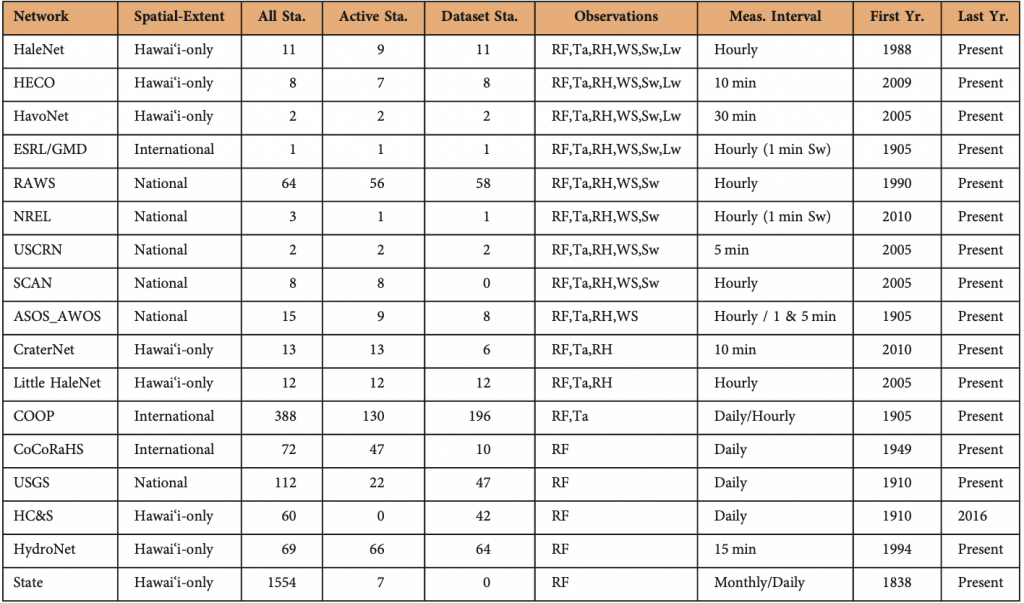
Climate networks in Hawai‘i. Where; Network is the measurement network; Spatial-Extent is the geographical extent of the measurement network; All Sta. is the number of stations identified within a given network; Active Sta. is the number of stations active as of 1 January 2017, Observations is the meteorological observations taken within a given network (RF = rainfall; Ta = Surface air temperature; RH = Relative Humidity; WS = Wind speed; Sw = incoming short wave solar radiation; Lw = downwelling longwave radiation): Meas. Interval is the measurement Interval used by each network; First Yr. is the first year of measurements; Last Yr. is the last year of measurements.
Researchers attempting to make use of available data are faced with a series of challenges that include: (1) identifying potential data sources; (2) acquiring data; (3) establishing data quality assurance and quality control (QA/QC) protocols; and (4) implementing robust gap filling techniques.
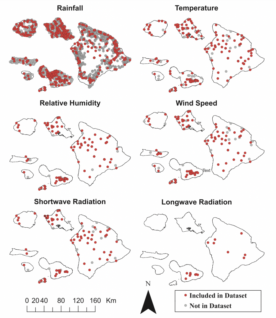
Spatial distribution of measured climate variables in Hawai‘i. Showing (red) stations included in the datasets accompanying this manuscript; and (gray) climate stations not included in the accompanying datasets.
This research was published in 2018 in the Nature journal “Scientific Data”. The paper addresses these challenges by providing: (1) a summary of the available climate data in Hawai‘i including a detailed description of the various meteorological observation networks and data accessibility, and (2) a quality controlled meteorological dataset across the Hawaiian Islands for the 25-year period 1990-2014. The dataset draws on observations from 471 climate stations and includes rainfall, maximum and minimum surface air temperature, relative humidity, wind speed, downward shortwave and longwave radiation data.
At present efforts are underway to update these data sets to present day and to continue the data collection and publication in near-real-time moving forward.