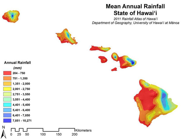
The popular 1986 Rainfall Atlas of Hawaiʻi is back, updated as an interactive online resource of the same name. See the Rainfall of Hawaiʻi website.
The Hawaiian Islands have one of the most diverse rainfall patterns on earth, and the original atlas was a frequently cited resource. Knowing mean rainfall patterns is critical for a variety of meteorological, agricultural and resource management issues, including ground water and surface water development and protection, control and eradication of invasive species, protection and restoration of native ecosystems and planning for the effects of global warming.
The rainfall site was developed by University of Hawaiʻi at Mānoa Department of Geography Professor Tom Giambelluca, who specializes in climate, climate change and ecohydrology, along with Assistant Professor Qi Chen, master’s candidate Abby Frazier and a team of UH Mānoa researchers. Giambelluca authored the 1986 atlas with Professor of Meteorology Tom Schroeder and then graduate research assistant Michael Nullet.
Developed to make rainfall maps, data and related information easily accessible, the website includes high resolution downloadable digital maps for mean monthly and annual rainfall. It allows users to view rainfall patterns with corresponding uncertainty, zoom in on areas of particular interest and click on any location to get data on mean annual and monthly rainfall.
The maps represent the best estimates of the mean rainfall for the 30-year base period 1978–2007. Rainfall measurements were taken at more than 1,000 stations over the course of the two-year map development project.
The 2011 Rainfall Atlas of Hawaiʻi was developed by the geography department as subcontractor to Honolulu-based Wil Chee Planning and Environmental firm under an agreement between the State of Hawaiʻi Commission on Water Resource Management and the U.S. Army Corps of Engineers.

