The Climate of Hawai‘i
The Hawaiian Islands have one of the most unique and diverse climates on Earth. Rainfall, temperature, solar radiation, and relative humidity gradients are so pronounced that continental-scale ranges can be found over relatively short distances (< 25 km) in Hawai‘i. These steep gradients make Hawai‘i an incredible place to conduct scientific research, but data and information are required to accurately characterize the patterns.
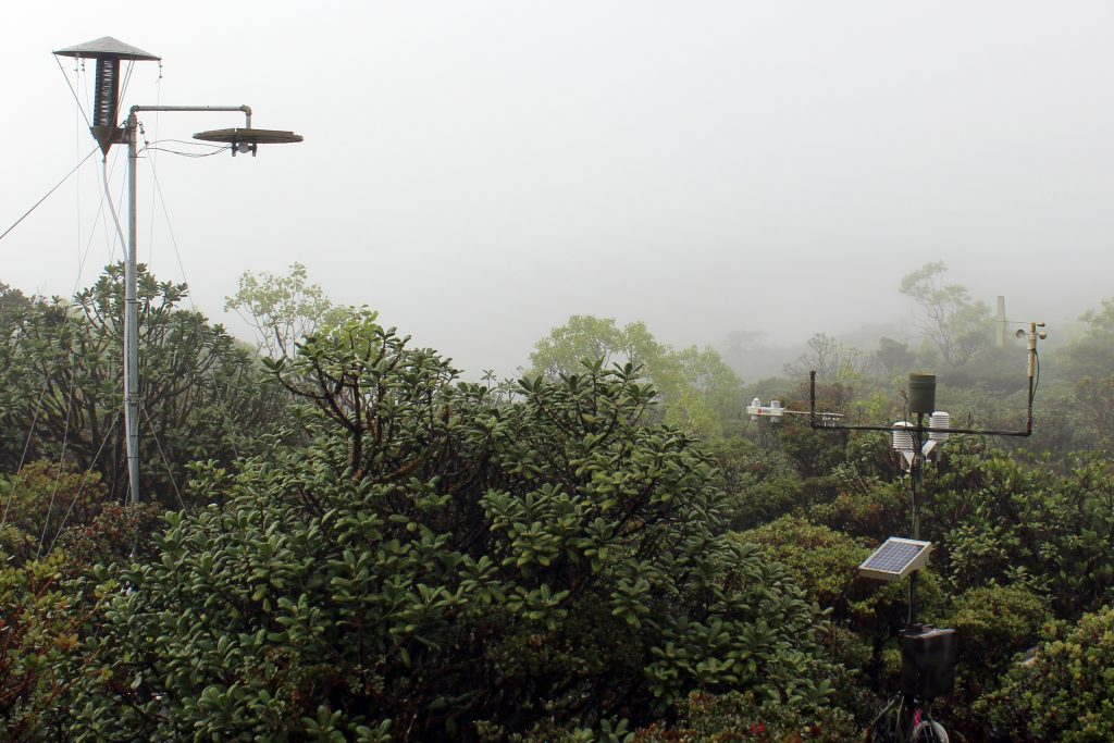
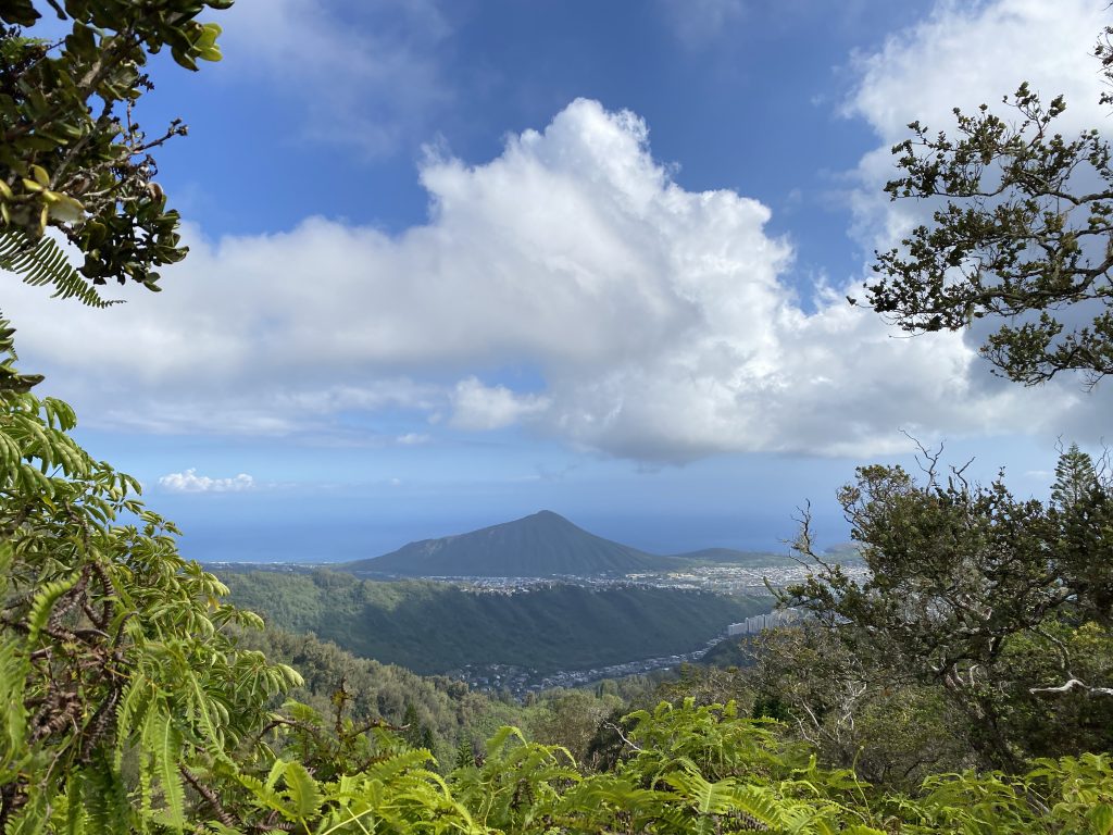
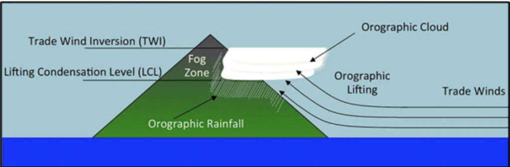
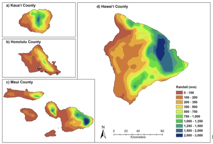
The climate is so diverse in Hawai‘i that four of the 5 Köppen major climate classification groups can be found on Hawai‘i Island alone. Wet-tropical climate occur along windward coasts, arid and semi-arid climates are found along some leeward coasts, temperate wet and dry climates can be found upslope on the highest islands (Maui and Hawai‘i) and polar climates predominate at the top of the three highest mountains in Hawai‘i (Mauna Kea, Mauna Loa and Haleakalā). The island chain is located in a relatively dry latitude, however, the interactions between topography and the persistent winds bring an abundance of rainfall to the windward slopes (Figure 2). Abundant water vapor in the air pushed up the mountains condenses and forms clouds at the lifting condensation level (LCL). But upslope flow is capped by the TWI on the highest islands (when it is present), leading to dry conditions at the higher elevations. The persistent wind-blown clouds in the zone just below the inversion add significant amounts of water and support a lush tropical mountain cloud forest.
Knowledge of climate patterns is critically important for a variety of resource management issues, including groundwater and surface water development and protection, controlling and eradicating invasive species, protecting and restoring native ecosystems, and planning for the effects of global warming.
Climate Data In Hawai‘i
The most challenging aspect of any analysis that utilizes station observations is the identification, acquisition, and quality control of the data. In Hawai‘i, climate data are available from a number of sources including, independent researchers, county, state, and federal agencies, and can be accessed via several large electronic repositories. The decentralization of these repositories is problematic because many of these data are stored in different formats and can require technical skills to access.
For many years, researchers at the University of Hawai‘i at Manoa (UHM) have been compiling and quality-controlling climate data to address a range of scientific research questions. Resulting in the production of gridded climate products such as rainfall and temperature maps. Descriptions of both gridded and point data are typically disseminated through either academic journals or technical reports, or through peer-to-peer networks. While authors are typically willing to share data products, a clear limitation of the process is that by the time products become available, the end dates of the data sets do not capture recent historical events. In short, climate data production lags months and years behind ongoing climate and weather events.
Evolution of HCDP
The idea for a centralized repository that can host quality-controlled climate data as well as gridded climate products for Hawai‘i has been in the making for over a decade, however, a lack of resources as well as several technical limitations have prevented its development. Beginning in 2018, as part of the Established Program to Stimulate Competitive Research (ESPCoR) ‘Ike Wai project, scientists from the Department of Geography and Environment (UHM), Hawai‘i Data Science Institute (UHM), the Water Resources Research Center (WRRC, UH) and the East-West center (EWC), joined forces and began working on an open source data and information sharing platform that has become Hawai‘i Climate Data Portal (HCDP).
As the HCDP project activities got under way, the research team became even more aware of the siloed nature of climate data and information in Hawai‘i. This prevented researchers from knowing of and assessing the full range of available resources. In addition, many land and resource managers have been unaware of the existing climate tools and data that are available. In light of these findings, the HCDP team began building additional features into the portal aimed at connecting users to the full range of climate data, information and decision support tools in the state.
In addition to the development of an easy-to-use interface that allows for both the visualization and downloading of meteorological data, an additional emphasis was placed on developing other HCDP features that could help improve information visibility and access. Some of these features are: a reference library with over 400-peer reviewed journal articles and technical reports, an archive of National Weather Service monthly rainfall summaries, highlights of past and ongoing research across the state access to a range of decision support tools, and information on indigenous climate knowledge perspectives.
The overarching goal of the HCDP is to provide streamlined access to high-quality reliable climate data and information for the State of Hawai‘i. This includes the production of both near-real-time monthly rainfall and daily temperature maps and a user-friendly tool to visualize and download them. Easy access to high quality climate data, information and products through the HCDP allows researchers to focus more time on their analyses and less time on data collection and processing. It also provides the broader community with access to information that would otherwise be inaccessible due to technical limitations. Finally, centralizing data and information helps to create more of a holistic environment for environmental stewardship in Hawai‘i.