New report confirms 2025 among Hawaiʻi’s driest, warmest on record
The inaugural Hawaiʻi Annual Climate Report 2025 detailed the second-driest year in over a century, with every single month recording temperatures above average.


The inaugural Hawaiʻi Annual Climate Report 2025 detailed the second-driest year in over a century, with every single month recording temperatures above average.

A new tool delivers personalized climate reports and wildfire risk data.

Federal funding cuts threaten Hawaiʻi’s climate resilience by ending support for vital sea level rise modeling and coastal planning research.

The Pacific Meridional Mode plays a major role in the variability of rainfall in Hawaiʻi.
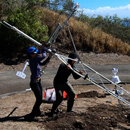
The Hawaiʻi Mesonet’s data has the potential to inform planning and decision-making in emergency management, agriculture, water resource, conservation and many other sectors.

They are now trying to make this concept a reality, having secured additional funding to develop a prototype this coming summer.

Unlike the current Red Flag Warning system these maps provide a daily, high-resolution look at the most current fire ignition risks statewide.

This year marks the 50th anniversary of key milestones in ENSO research.

Research reveals parts of Hawaiʻi, particularly Oʻahu's south shore, are sinking significantly faster than previously thought, accelerating the timeline for increased flood risk.

This research ties into the larger effort by UH Mānoa researchers and their collaborators to address climate challenges through a $26 million project to develop sustainable refrigerant technologies.
