Real-time weather dashboard launched by UH
The Hawaiʻi Mesonet’s data has the potential to inform planning and decision-making in emergency management, agriculture, water resource, conservation and many other sectors.

The Hawaiʻi Mesonet’s data has the potential to inform planning and decision-making in emergency management, agriculture, water resource, conservation and many other sectors.

Unlike the current Red Flag Warning system these maps provide a daily, high-resolution look at the most current fire ignition risks statewide.

UH Mānoa was ranked in four broad subject areas and 22 narrow subject areas.

Xia concluded her visit with a public lecture.

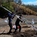
Ryan Perroy and Seth Quintus received a $1.15 million grant from the National Park Service to complete the study.

Professor Brian Szuster hosted a training session in Bangladesh to empower a new generation of rural development professionals.

Katie Gaut helped create an online map that documents sewage pollution issues at Puakō, backed by scientific research conducted at UH Hilo.

UH Hilo’s Uluākea program is designed to teach faculty to gain a more authentic understanding of Indigenous ways of knowing the world.
Thompson learned to sail using traditional methods of stars, wind and waves from master navigator Mau Piailug of Satawal.

Linguistics led the UH Mānoa rankings at No. 10 in the U.S. and No. 22 in the world.
