
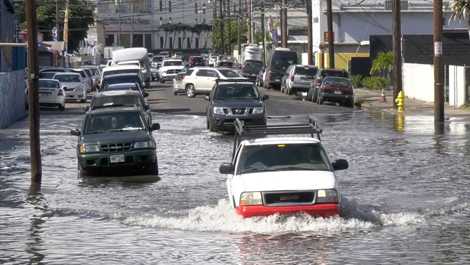
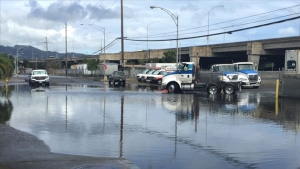
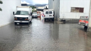
As sea level continues to rise, extreme high tide events cause Honolulu to experience flooding not just from water washing directly over the shoreline, but also from groundwater inundation as the water table is pushed toward the surface, and reverse flow through the municipal drainage system. According to a study published in Scientific Reports, researchers at the University of Hawaiʻi at Mānoa School of Ocean and Earth Science and Technology (SOEST), found in the next few decades, sea-level rise will likely cause large and increasing percentages of land area to be impacted simultaneously by the three flood mechanisms.
Further, they found that groundwater inundation represents the most extensive flood source, while direct marine inundation represents the least extensive—only three percent of the predicted flooding.
“This is significant because many people think that sea level rise can be mitigated by seawalls,” said Shellie Habel, lead author of the study and coastal geologist and extension agent with the UH Sea Grant College Program and UH Coastal Geology Group. “But a seawall will not stop groundwater inundation. Our results highlight the need to readjust our thinking regarding the flooding that accompanies sea level rise. We want to be sure to implement flood management strategies that will be effective at mitigating flooding.”
This requires that all types of flooding be thoroughly assessed.
Identifying vulnerable locations, infrastructure
Habel and co-authors developed a method that identified the various flood types and their extent. Flood maps were produced by simulating flood locations and depths generated by each of the three mechanisms and by overlapping the simulations to identify areas vulnerable to combined flooding over the coming decades.
Colleagues at the UH Sea Level Center then developed a statistical model that considers predicted tide and projected magnitudes of local sea-level rise to establish the frequency with which flooding is likely to occur in given locations. With these flood simulations, the research team assessed critical infrastructure that is likely to fail and cause direct impacts, such as dangerous or impassable roadways, storm drainage inlets likely to fail or act as pathways for additional flooding, and non-functional or flooded cesspools.
The impacts were found to be widespread among Honolulu’s heavily densified primary urban center. This work along with planned collaborations will provide information that can inform the development of short-, mid- and long-term flood management strategies.
For more see SOEST’s website.
—By Marcie Grabowski
