Ritidian Point wave buoy redeployed to serve Guam communities July 21, 2015 UH News PacIOOS redeploys wave buoy outside of Ritidian Point to measure wave height, direction, temperature and more.
New tool forecasts high sea levels and potential flooding on Kwajalein Atoll July 15, 2015 UH News Pacific Islands Ocean Observing System tool gives hourly updates of potential high sea levels and wave inundation for Kwajalein Atoll.
Wave buoy back online to serve Northern Mariana Island communities July 1, 2015 UH News PacIOOS wave buoy redeployed off Tanapag, Saipan.
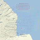
Ocean surface currents now being measured in near real-time off Hilo June 22, 2015 UH News Online, real-time data on the direction and speed of ocean surface currents off Hilo made available by the Pacific Islands Ocean Observing System
Ocean users asked to keep distance from Hilo Bay wave buoy March 10, 2015 UH News The Pacific Islands Ocean Observing System asks ocean users to carefully navigate around the wave buoy.
Study reveals tiger shark movements around Maui and Oʻahu November 26, 2014 UH News UH Mānoa researchers track tiger shark movements in coastal waters around Maui and Oʻahu
PacIOOS wave buoys serving communities across the Pacific November 3, 2014 UH News The Pacific Islands Ocean Observing System deployed a new wave buoy in the waters off Aunuʻu, American Sāmoa.
Wave buoy in Majuro helps keep islanders safe July 10, 2014 UH News PacIOOS collaborated with partners to deploy a new Datawell Directional Waverider buoy named Kalo about one mile off the eastern shore of Majuro.
New tools forecast potential sea level flooding events July 9, 2014 UH News A team of physical oceanographers working with the Pacific Islands Ocean Observing System has developed new tools to forecast potential inundation events.
New model predicts Ala Wai Canal brown water runoff June 12, 2014 UH News UH Mānoa oceanographers and the Pacific Islands Ocean Observing System have created the PacIOOS Ala Wai Turbidity Plume Model.