
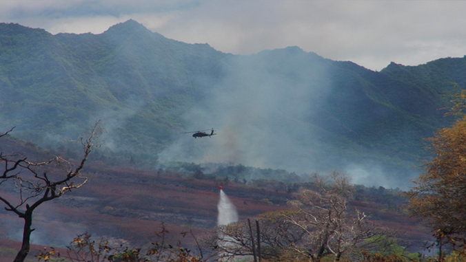
Recent wildfires ravaging the West Coast highlight the importance of preparation and understanding the threat everywhere, including Hawaiʻi. A team at the University of Hawaiʻi at Mānoa will work to improve assessment and communication of unique wildland fire risk the state faces.
The UH Mānoa Water Resources Research Center (WRRC), the Wildland Fire Extension Program (College of Tropical Agriculture and Human Resources), and the Department of Civil and Environmental Engineering (College of Engineering) secured nearly $1 million in funding for the project. The grant is from the Federal Emergency Management Agency (FEMA) through partnership and cooperation with the Hawaiʻi Emergency Management Agency (HI-EMA) and UH Mānoa.
The project will develop a high-resolution fire risk index for Hawaiʻi using spatial data on historical fire occurrence, climate, vegetation and the built environment. The end-product will be a daily map of fire risk for the state published online that uses real-time climate products produced by WRRC and the UH-based ʻIke Wai program. This work will be led by Sayed Bateni (principal investigator), associate professor in civil and environmental engineering and WRRC, Clay Trauernicht (co-principal investigator), extension specialist in ecosystem fire in the Department of Natural Resources and Environmental Management, and Tom Giambelluca (co-principal investigator), director of WRRC.
“The incredible diversity of climate types and vegetation in Hawaiʻi means that the standard fire prediction tools used on the mainland simply don’t work for us. This effort will use climate products developed for Hawaiʻi and integrate local knowledge of forecasters and fire responders to validate and interpret the final product,” said Trauernicht.
Developing comprehensive fire-risk alert system
Beyond mapping daily fire risk, WRRC and UH Cooperative Extension will work with the National Weather Service and federal, state and county emergency responders to integrate the maps into the current Red Flag Warning System and agency readiness plans. The only fire-risk alert system actively in place is the Red Flag Warning System by the National Weather Service.
However, because the system is based on a single weather station, red flag warnings may not represent conditions across the state or a red flag may not be declared despite high risk conditions elsewhere. For example, no red flags were declared during any of the multiple, record-breaking large fires on Maui in 2019 due to different rainfall patterns over Honolulu. The project will also use the fire-risk index to examine the historical frequency of fire-risk conditions across the state and work with the non-profit Hawaiʻi Wildfire Management Organization to educate land managers, planners and the general public about how the products can inform proactive risk reduction efforts.
“As our constant brush fires present new challenges to us during both hurricane season and a pandemic, HI-EMA’s hazard mitigation program grant program is critical in getting the proper funding to battle these threats,” said HI-EMA Administrator Luke Meyers.
Fires cost in land skyrockets over years
Wildland fire is a persistent and increasing threat across Hawaiʻi and places significant burden on federal, state and county emergency management agencies. The annual area burned has increased by 300% across all four counties of Hawaiʻi within the past several decades, such that fires often burn a greater proportion of Hawaiʻi land area than many states in the Western U.S. Fire-risk warning is especially critical in Hawaiʻi both due to the vulnerability of populated areas and natural resources to fire impacts and because the majority of wildland fire ignitions are caused accidentally by people.
