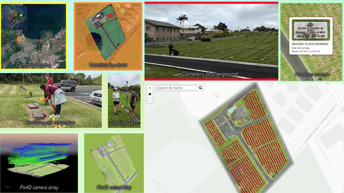
Visitors to the East Hawaiʻi Veterans Cemetery No.1 grounds in Hilo have a new map to assist them in locating gravesites thanks to a map created by student geographers from the University of Hawaiʻi at Hilo. The team used drones, hands-on fieldwork and extensive geographic information system (GIS) programming to create the map.
The online map gives viewers an overhead view of the cemetery allowing them to click on each gravesite to see a photo of each gravestone. Viewers can also search by name.
The project was conducted under the guidance of Ryan Perroy, a professor of geography and environmental science and director of the UH Hilo Spatial Data Analysis and Visualization (SDAV) Laboratory.
“This has been a multi-year effort and we are now ready to share the mapping project with the public,” said Perroy. “We are honored to give something back to our veterans and their families.”
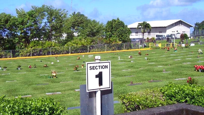
East Hawaiʻi Veterans Cemetery No. 1 is a resting place for more than 1,500 fallen soldiers and family members. Veterans from World War I, World War II, Vietnam and Afghanistan are laid to rest there.
GIS is the hallmark activity of the SDAV lab. Students utilized integrated computer hardware and software to analyze and visualize geographic data.
The project served as a learning experience for 48 students in various classes throughout the past three semesters such as field methods in geography, geographic information systems and visualization and advanced geo-spatial techniques. The work involved differential global positioning systems or GPS, GIS, photogrammetry, fieldwork, drones and web mapping. UH Hilo undergraduate geography student Kanoa Lindiwe took the lead on the project, and graduate student Trina “Nikki” Henry, currently in the tropical conservation biology and environmental science master’s program, also contributed.
The mapping project was conducted in partnership with the County of Hawaiʻi Department of Parks and Recreation. Staff from the UH Hilo Spatial Data Analysis and Visualization Lab also contributed.
For more go to UH Hilo Stories.
—By Susan Enright