
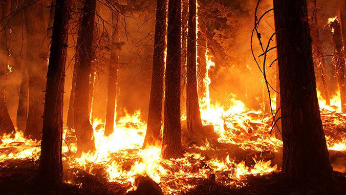
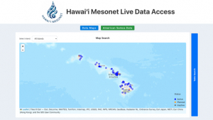
A new real-time dashboard launched by the University of Hawaiʻi at Mānoa offers public access to live weather data from nearly 70 monitoring stations across the state, marking a major milestone in the Hawaiʻi Mesonet project. The launch coincides with Wildfire Awareness Month and represents a pivotal moment in the effort to make climate data available to the public.
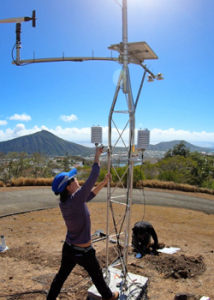
Hawaiʻi’s diverse geography and microclimates present unique challenges that require precise monitoring to accurately capture weather events. Annual rainfall in parts of Maui, for example, can vary by more than 140 inches within a single mile. The Hawaiʻi Mesonet’s data has the potential to inform planning and decision-making in emergency management, agriculture, water resource, conservation and many other sectors.
Developed by an interdisciplinary team of scientists at UH Mānoa and the Hawaiʻi Department of Land and Natural Resources, the project aims to deploy 100 high-tech weather stations to provide critical data for forecasting, disaster response and improving climate resilience. The dashboard is expected to play a critical role in supporting wildfire and flood early warning systems, particularly as climate-related disasters are expected to become more frequent and severe.
The dashboard allows users to view current weather conditions at stations spanning the Hawaiian Islands, including temperature, rainfall, wind, humidity, solar radiation and soil moisture. The real-time data is updated every 15 minutes, creating one of the most comprehensive and timely weather data resources available in the state.
“This dashboard represents years of effort to build a system that’s tailored to Hawaiʻi’s unique needs,” said Tom Giambelluca, Hawaiʻi Mesonet project lead, long-time professor in the Department of Geography and Environment, and former director of the UH Water Resources Research Center (WRRC) “It’s not just about data—it’s about giving our communities the tools to adapt and respond.”
The launch comes as federal agencies such as the National Weather Service and NOAA face data removal and staffing cuts under the Trump administration. With gaps in data availability growing, the Hawaiʻi Mesonet system is poised to become a key source of reliable, localized weather intelligence.
Data from the system is stored in Hawaiʻi Climate Data Portal (HCDP), which is available to the public and is used to create recently launched new wildfire risk maps and other climate maps. The HCDP pulls data from multiple sources, including the Hawaiʻi Mesonet and as well as other federal datasets.
“The real concern is that most of these federal datasets will no longer be available in the near future—making the Hawaiʻi Mesonet and the HCDP the sole resource for real time weather and climate information in the state,” Pacific Islands Climate Adaptation Science Center University Consortium Director Ryan Longman said. “A big uncertainty is how the state will fill critical funding gaps left by the federal government to support these important efforts.”
For more information, visit the Hawaiʻi Mesonet website.
